Most common power line inspection challenges
Power line inspections will always face different challenges, stemming already from how power lines are built. They have to connect producers to users in the shortest way possible to avoid power losses on the way, thus they oftentimes have to cross all sorts of landscapes and terrains. From marshlands, swamps and thick forests to hills and mountains – power lines go over everything. But seeing as access to reliable electricity connection has become vital for our way of life, power grid operators have to inspect and maintain their lines regularly and adequately. To accomplish this, grid operators have to solve multiple different problems successfully. Below you can read how grid operators solve the three most common power line inspection challenges.
Terrain and landscape
When power lines cross difficult and hard to reach terrain, that means that to inspect the power lines, inspection crews have to find a way to cross it as well. For on-foot patrols, this is a considerable challenge, slowing both the traversing speed and the data collection sometimes to a halt. This is especially true in forested areas, where the thick vegetation also limits what is visible from the ground. With shallow wetlands and marshes it is even more difficult, as they can’t be traversed on-foot and oftentimes are too shallow for boats.
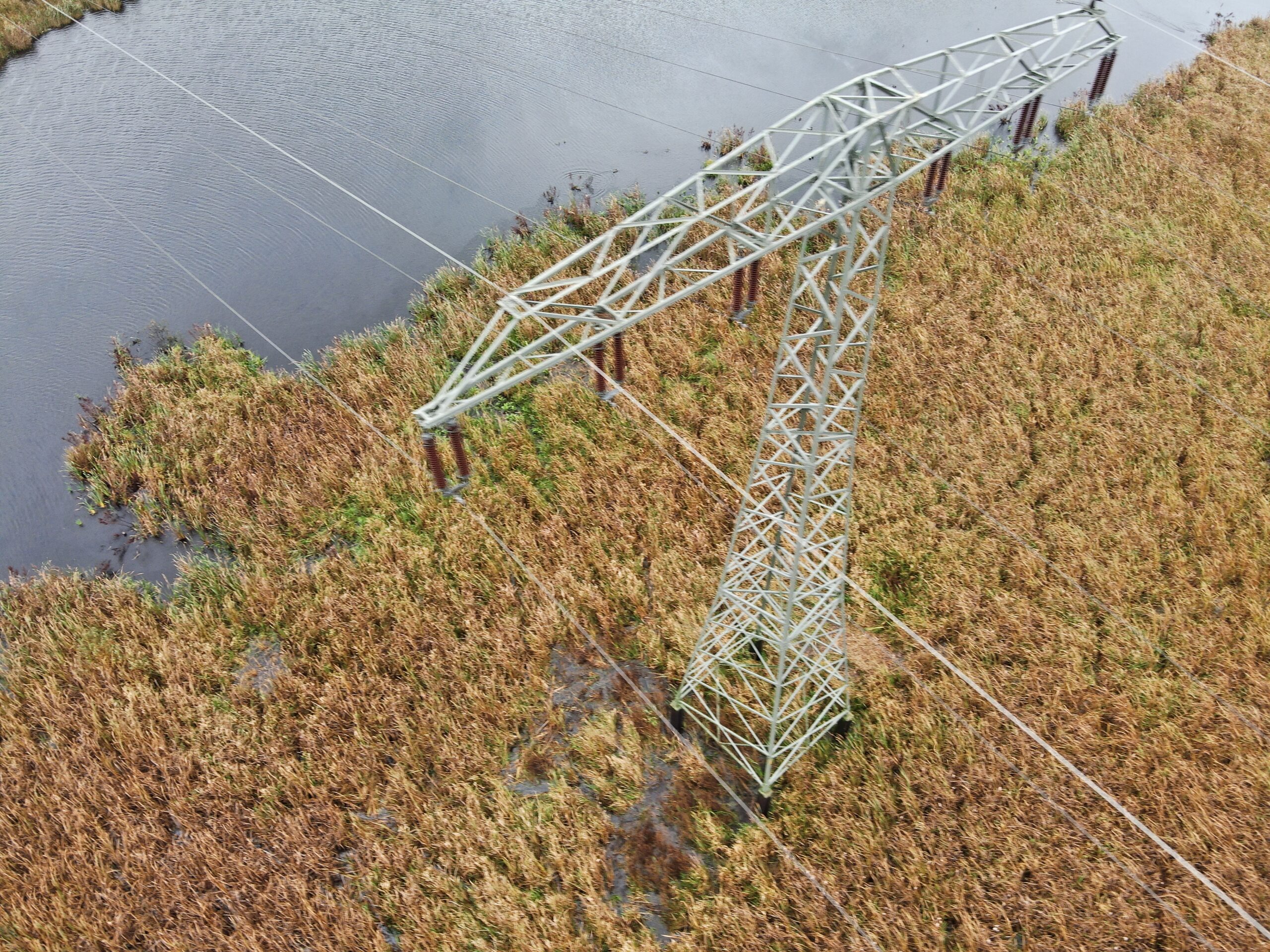
Power line crossing a moor near Demmin, Germany
While the landscape can and will put even the ablest inspection teams to the test on the ground, it rarely affects data collection with drones and helicopters. Able to fly over different obstacles, they can give grid operators a birds-eye view of the power lines and towers. This speeds up the data collection process, allows for greater defect detection and saves the inspection teams from traversing difficult terrain.
Even though drone and helicopter teams have the ability to fly over obstacles easily, they have to keep in mind their surroundings. This is especially important in mountainous areas, where high elevation differences between the lines and wind corridors can complicate flights. That is why Hepta’s operations team always scouts the flight areas and does meticulous flight planning ahead of flights. Having a full understanding of power line inspection challenges and opportunities allows drone teams to succeed with their operations.
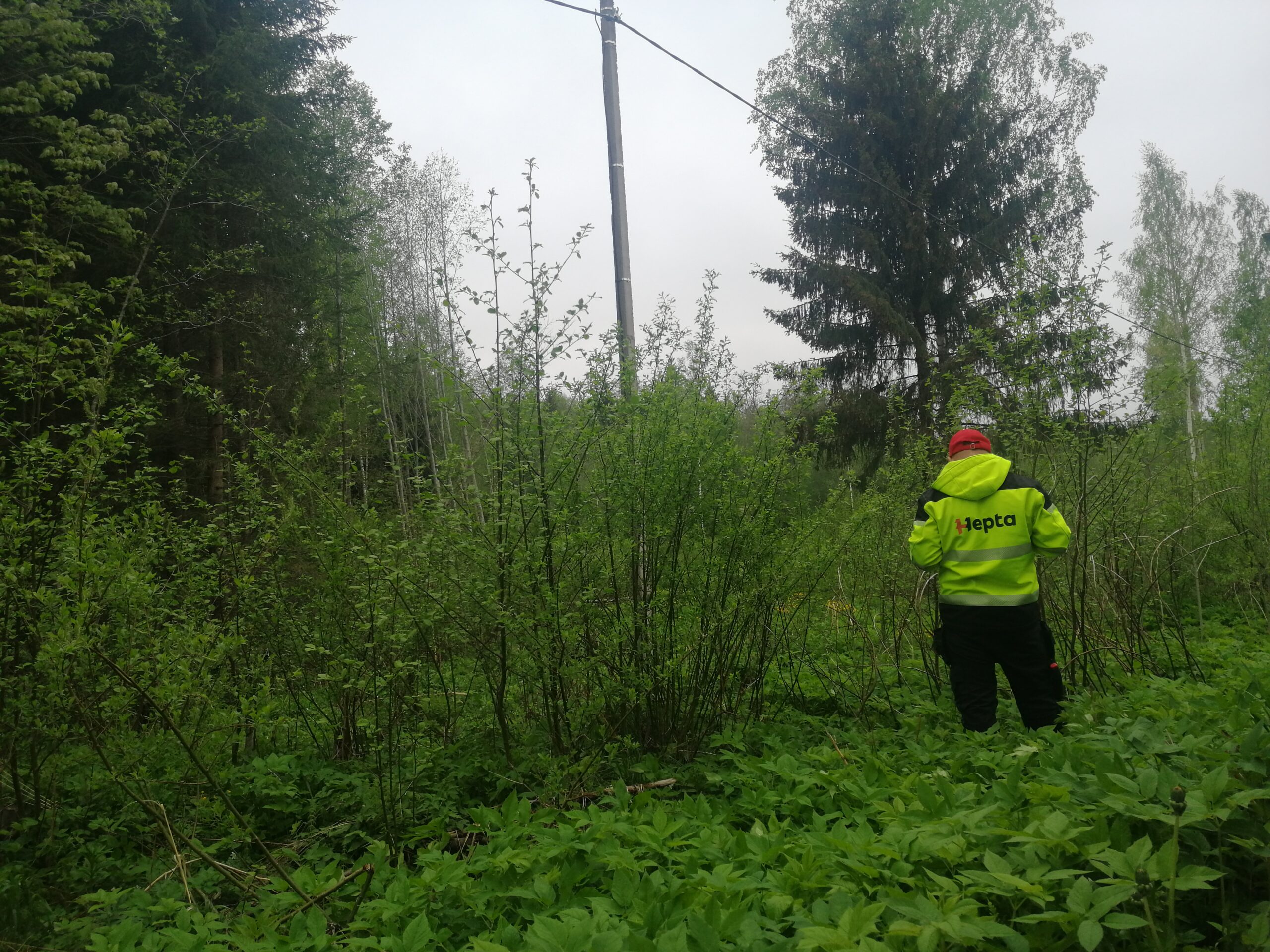
Power line inspection conducted in overgrown vegetation
Flight permits
Once a grid operator has chosen to speed up and improve the quality of their inspections with drones, they have to keep in mind the regulations regarding drone flights. Since 1. January 2021 the civil drone operations are regulated by the EU Regulations 2019/947 and 2019/945. The framework divides drone operations into three categories:
- “open” (lower-risk civil drone operations, restricted to VLOS and flights below 120 metres)
- “specific” (risk assessment needed for flight permits, restricted to operations specified in the authorisation)
- “certified” (both the drone and the operator have to be certified by the NAA)
Most of the data gathering with drones is conducted using the “open” category, thus allowing for ease of use. At the same time, the behind visual line of sight or BVLOS flights are only available using the “certified” category, which is much more stricter. BVLOS operations require extremely careful planning by operators with a framework process in place with most Aviation Authorities, in which to justify and explain the procedures to be followed during the flight. While operations outside of a pilot’s line of sight have been available for some time under BVLOS provisions, the pilot training requirements are generally arduous, and approvals are issued on a location-by-location, case-by-case basis. Thus getting flight permits from the Aviation Authority for BVLOS drone flights, even for data gathering, is oftentimes difficult.
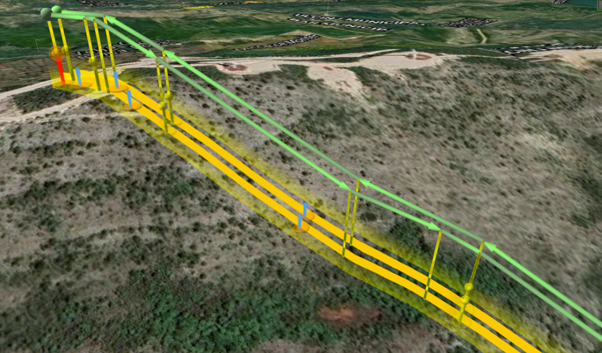
Visualized BVLOS flight plan
To increase your chances of successfully applying for the BVLOS flight permits, meticulous planning and preparation have to be conducted. Pilots have to have the A1/A3 EASA certificate, operations manual of the flight has to be created, in addition to the risk assessment for the specific flight route and a detailed description of the flights, takeoff and landing areas and potential hazard areas. If the flight path is crossing highways and/or railways, permission from their operating authority has to be granted. That also applies to local parks or nature preservation departments, should the flight path cross protected natural areas.
Hepta’s experience shows that if the inspected power line does not cross or run next to military or border areas, nor any high-security objects, such as prisons or airfields, correct documentation and strict adherence to the regulations allow for successful BVLOS flight applications majority of times.
Weather effects
To maximize both the data collection quality and the performance of drones, the weather effects on operations have to be taken into account. Both high winds and precipitation can affect the drones and the data collected with them. Meanwhile, temperature extremities such as temperatures over 40 degrees Celsius or below -20 can limit the battery life of drones. Yet the power line inspection challenges posed by the weather are diminishing constantly as the technology becomes more and more advanced.
Today, drone operators can conduct successful data gathering even during windy and precipitous days. But once the weather is approaching storm-scale (over 18 m/s wind) or there is a heavy downpour, it is highly advisable to stop all flights. Strong winds make controlling the drone difficult and focused data gathering hard. Similarly, high precipitation can distort the captured images and create artefacts in the LiDAR point clouds, thus it should be avoided.
While Hepta’s operations team regularly conducts post-storm power line inspections in difficult conditions, the best solution for power grid operators is to postpone flights, once the weather becomes too difficult. Seeing as storms rarely last longer than a day, it is advisable to forgo putting the drones and the pilots into potentially dangerous situations and wait for the weather to clear. Especially seeing as the data gathering tempo in those kinds of situations tends to be lowered substantially.
Conclusions
The rate of electrification puts power grids all over the world under the pressure. Network operators have to make constant efforts to maintain their grids and avoid outages which could affect a large number of consumers. That is why the importance of well maintained and well-inspected power grids is ever-growing. Hepta allows grid operators to tackle their power line inspection challenges successfully through an AI-driven inspection platform uBird. uBird allows grid operators to use any data gathering method, they choose (drone, helicopter, satellite, on-foot patrols) and increase their analysis speed and quality through machine learning algorithms. Click here to book a call with one of Hepta’s inspection experts and see a live demo in action!
31.05.2022