When thinking of power line inspections, one cannot but think of words like ‘time-consuming’, ‘expensive’, and ‘overall tiresome’. Still, however unpleasant the job might be, it’s necessary; you can’t just set up power lines and forget about the maintenance. Maybe there’s a way to take the load off your shoulders. Maybe there’s a way to automate this cumbersome process. Is there a way to do it more safely, remotely? Well, we’re glad you asked.
A groundbreaking way to inspect power lines
Traditional inspection techniques are typically extremely time-consuming and labor-intensive. The ground-based method is a massive workload and can be somewhat hazardous for the staff. So what’s the alternative? Look up to the sky!
Hepta has perfected power line inspection using unmanned aircraft to the level where it is commercially useful. Airborne power line inspection is steadily growing in popularity, with the market for drones in the power and utility industries expected to reach $515 million by 2030.
Customers who have been taking advantage of this technology are already getting increased efficiency and lower costs brought about by shorter inspection cycles, more accurate defect detection, and nullified safety risks.
However, despite the growing use of unmanned aerial vehicles (UAVs) for aerial inspection, large-scale implementations are still uncommon. Most operators continue to tread with care and favour thorough evaluation and testing to ensure long-term stability over rapid adoption. Moreover, given the technological and legal complexities of aerial inspection, only a handful of companies have figured out how to deliver a service that meets commercial use requirements.
Having built a commercially viable automated UAV-based power line inspection business, Hepta now routinely covers over three thousand kilometres monthly and has helped clients shorten inspection cycles by three times as well as halved related costs.
The take-off of Hepta
From its inception, Hepta’s chief mission has been to find the best way of conducting power line inspection. The first experiments involved crewed helicopters, which turned out to be an unsustainably expensive method. Other than the high operational costs, fully manual inspection is rather slow and prone to errors, making it expensive in both the short and the long term. It’s also something most operators already live with. Things needed to change.
The Hepta unmanned aircraft trials and tribulations
It’s the twenty-first century. Automation isn’t the future anymore; it’s becoming a bigger part of our present. Power line inspection by drones speeds the processes up by two to three times and, on average, discovers 150% more faults. However, not all drones are created equal. In a quest to produce optimal hardware for aerial power line inspection, Hepta went through three stages.
The fixed-wing drone
Fixed-wing drones were the first subjects of the Hepta founders’ UAV experiments. While they showed promising results compared with manned helicopters, significant limitations hurt their viability – strong dependence on weather conditions, minimum speed limits, take-off and landing sites, etc.
The multi-rotor aircraft
The fixed-wing drones’ weaknesses urged the founding team of Hepta to explore a different avenue: multi-rotor drones. Smaller and more agile, these drones avoided issues related to minimum speeds, required no investments for take-off and landing points, and had no difficulties regarding approachability. However, the multi-rotor drone isn’t helpful in large-scale inspections, thus rendering it useless for power line inspection, where the aircraft should travel for hundreds of kilometres.
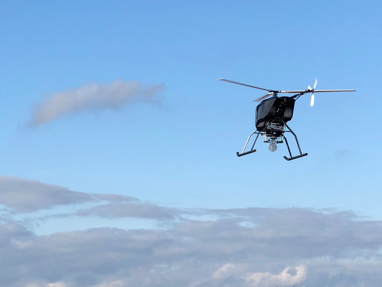
The third time’s the charm: The UAV helicopter aircraft
Hepta set out to develop in-house aircraft suited explicitly for power line inspection in small areas that could cover long distances. This inspection-optimised UAV takes the form of a helicopter and has none of the other vehicles’ shortcomings.
The Hepta H19 helicopter aircraft is powered by a hybrid engine (ICE + electric) that ensures hardware reliability and safety. Such a system minimises the involved risks and is viewed as a bonus by the aviation authorities when granting flight permits. Currently, Hepta’s helicopter is in its third version, with each version improving upon the last and with dozens of further upgrades in the works.
Siim Heering, Co-founder & CRDO of Hepta commented why helicopter type of drones are best suited for utility inspections: “Helicopter drone design has the potential to achieve longer flight times compared to multirotor drones due to higher aerodynamic efficiency. On average, helicopter drones are capable of handling bad weather situations better thanks to having a superior control surface system. Considering maximizing the performance in the future and developing a parallel hybrid system, it is easiest to be achieved on helicopter-type aircraft frames.
Also H19 drone performs pretty much every task the VTOL airplanes do, but they can not do every task that H19 does- for example flying in very low airspeeds and hovering for extended periods of time. (These are crucial for capturing data with a LiDAR sensor and taking sharp images of defects.)”
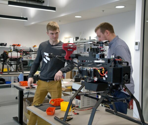
Hepta team members Kaupo Kaust and Siim Heering
Different UAVs, different use cases
DJI drones
DJI (Shenzhen DJI Sciences and Technologies Ltd.) is the world leader in commercial drone development.
The DJI Mavic Enterprise Dual drone is the company’s smallest and most powerful drone, which can detect defects and faults on low- and middle-voltage lines, where the access space is narrow. It is essential to be as unobtrusive as possible in places like these as lines are likely to cross private property, so using a big and noisy machine is not an option. Smaller drones also pose less risk to the environment.
The DJI Matrice Series 300 and 600 can capture data on a less-than-industrial scale – not hundreds of kilometres. The main difference between these machines is that medium-sized drones are quieter than big ones, and smaller ones mean smaller risks. Also, getting flight permits is often easier as regulators are more likely to be familiar with more broadly used drones and smaller ones are easier to operate. The maximum payload for smaller drones is four kilogrammes; it is quite impressive as it can stay in the air for thirty to fifty minutes, depending on the payload.
These drones can carry several sensors. Drones usually carry one or two payloads simultaneously, but they cannot carry much more as there are weight limitations and sensor compatibility issues. Larger drones, however, can carry multiple, heavier and more accurate payloads – infrared (IR), LiDAR, RGB, and camera, with room to spare. On industrial-level missions, when it is needed to cover one hundred kilometres in three hours or two hundred kilometres per day, the biggest drone developed by Hepta specifically for the needs of aerial inspections, the H19, is used.
Compatible sensors
It is possible to use various sensors in combination with different drones:
Optical sensors allow taking RGB images of defects and line.
Measurements collected via LiDAR do not provide the end result; they only provide raw data. LiDAR cloud point data need to be combined, classified, cleaned up, etc. After such processing, accurate measurements can be performed, like vegetation height, wire height, tower tilt, and others. Then the data can be uploaded to uBird and used. An orthomosaic is created together with LiDAR. It creates an exact ortho map during the LiDAR missions. This allows the generation of a perfect geo-reference. Orthomosaic images combined with LiDAR data can be used to visualise vegetation height using color-coding.
Thermal sensors allow the detection of flashovers, thermal defects, and other elements that are significantly hotter than their surroundings. uBird also measures the temperature of an object; the user needs only to move around the cursor. Thermal or infrared imaging is also compatible with uBird power line and utility inspection software.
Corona camera allows detection of Corona discharge effect
uBird power line and utility inspection software
The last leg of inspection is analysing the gathered data. uBird is the first end-to-end power line inspection software. The solution uses high-end tech to automate the data analysis of power lines and enables the digitalisation of the whole grid infrastructure on a large scale.
The uBird platform can process optical (RGB) photos and use machine learning to identify the most common defects. Inspections can also be performed manually, identify faults, and produce reports in many different formats: online in the cloud, CSV tables, Excel tables, and PDF reports, depending on the customer’s needs. Most standard output formats are PDFs; reports of the defects can be printed and customised to ease the work of line technicians. uBird can be integrated with almost any other system, and for one of our customers, it has been integrated with SAP.
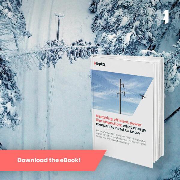
Are you ready for the lift-off? Read our free e-book Mastering efficient power line inspection: What energy companies need to know to learn more about how to save time and costs on power line monitoring.
09.02.2021